Difference between revisions of "Mapping:Index maps"
(No difference)
|
Latest revision as of 22:25, 9 February 2010
An index map is an array of integer values (one for each grid cell) that represent unique IDs for the different spatially distributed properties being defined. The typical maps (although not restricted to) are derived from:
- A land use (land cover or vegetation cover) coverage.
- A soil texture coverage.
- A combination of land use and soil type coverages where all the combinations of land use and soil texture are determined with an ID created for each unique pair of overlapping polygons.
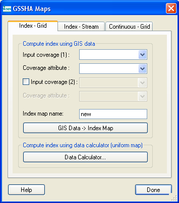
The Maps dialog is used to create and manage different index maps used in WMS. This dialog is shown in Figure 7.
Several options exist for creating index maps including:
- Importing an existing grid file.
- Mapping a GIS coverage.
- Setting a constant value for all grid cells.
- Interpolating from a data set.
The following sections describe the key elements of the Index Maps dialog.
The Index Maps window contains a list of maps created for the GSSHA project. A new map can be created using the Add Map button, and the Rename Map button can be used to give it a more meaningful name. The Copy Map and Delete Map buttons can also be used to add or delete maps from the list.
The Import button allows a GRASS ASCII grid to be imported and used as an index map. The Import command is primarily used when the GRASS GIS is used as a companion to WMS for GSSHA model development. The imported grid must be of the same resolution as the GSSHA grid already created in WMS. Unless both of these grids are created in GRASS, this is unlikely to be the case. The Export command can be used to save an ASCII grid of the selected index map. This function is most useful if you wish to view the grid with ArcView or other GIS software.
Related Topics
GSSHA Wiki Main Page
Primer Main Page
