Difference between revisions of "Mapping:Mapping tables"
(No difference)
|
Latest revision as of 22:32, 9 February 2010
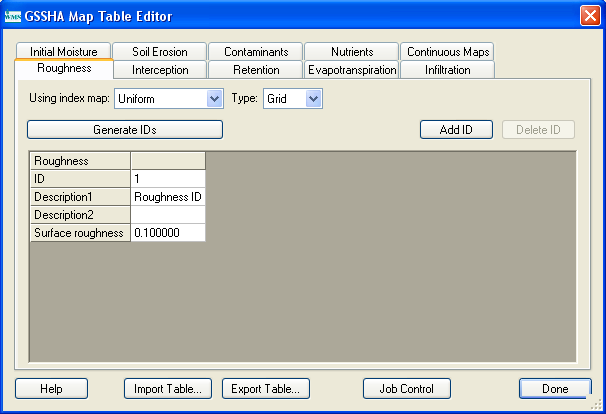
Mapping tables are used to relate index map IDs to parameter values. The required values depend on which simulation options are selected. The most basic value is surface roughness, but if infiltration, evapotranspiration, or other options are defined then the parameters for each of those options will also need to be defined. The mapping table editor, shown in Figure 7, is accessible by selecting the Mapping Tables… command from the GSSHA menu, or by using the Edit Mapping Tables… button in the index map dialog.

The GSSHA™ Map Table Editor, shown in Figure 8, allows you to select a process, generate table IDs for that process, and define the parameter values for the IDs of the table. If you try to select a process (evapotranspiration, for example) that has not been enabled in the Job Control dialog, you will be prompted to turn on that option if you wish to define parameter values for the IDs. Each active process must be associated with an index map, assigned from the Assigned index map drop-down combo box.
The Generate IDs from map button will generate a new table ID from each unique ID in the map. You can also Add or Delete a given ID using the appropriate buttons. To define parameter values for a given ID, you should select that ID from the ID window. Edit the corresponding values for that process by selecting the appropriate line in the Selected ID Property window and change the value in the edit field just below it.
You can export a table for later use if you have a certain set of parameter values that correspond to a standard classification system of soils or land use. This table can then be imported for use in the development of other GSSHA models.
Related Topics
GSSHA Wiki Main Page
Primer Main Page