Routing:Tips on creating lakes
- Set up one lake at a time. When it is working, go on to the next lake.
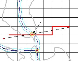
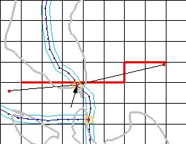
- Make sure outlets are placed upstream of the embankment.
 |
|
| Fig. 17. Good | Bad |
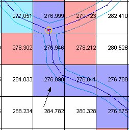
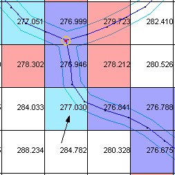
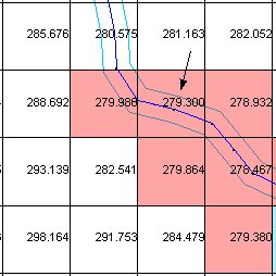
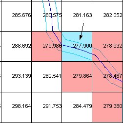
- Lakes are filled according to cell elevation. Streams need to be swallowed from downstream to upstream. Thus, the cell elevations along the streams must always increase from the min WSE cells to where the stream enters the max WSE.
 |
|
| Fig. 18. Good | Bad |
 |
|
| Fig. 19. Good | Bad |
- Set the minimum WSE to cover the cell elevation irregularities along any (supposed) stream network in the lake bottom.
- You don’t have to have a stream going through the lake. You can have a polygon a little smaller than the minimum WSE and have the incoming streams connect to it.
|
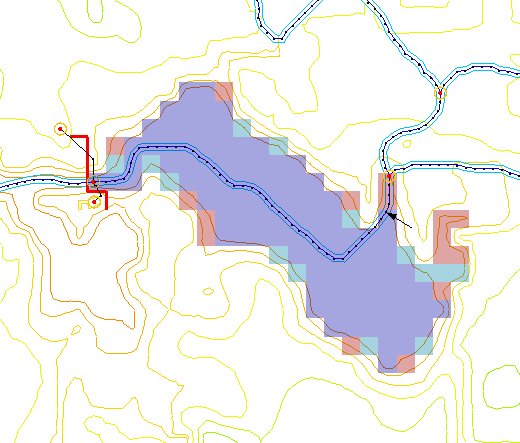
| Fig. 20. |
A lake with a stream running through it. The stream will not be used in the simulation from the arrow onward because it is below the minimum water surface elevation. (Note that part of the stream, just below the arrow, that exits the lake. The stream must be realigned to lie within the lake for the lake to work properly.)
|
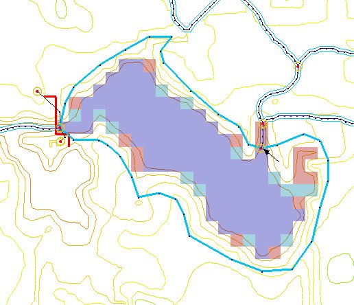
| Fig. 21. |
The same lake as above, but defined on a polygon. The extents of the polygon do not actually enter into the calculations of the lake extent in GSSHA; they are merely for visual reference. The lake polygon is only used to assure stream connectivity. One very important point, however, is that the incoming streams need to extend into the minimum water surface elevation zone. As all stream arcs entering and exiting the lake must be connected to the lake polygon, the boundary of the lake polygon must also be inside the minimum water surface elevation at the point where the lake and an incoming stream meet.
- Set the maximum WSE to be the biggest the lake could realistically ever grow. There is no problem if the lake doesn’t grow to the maximum extent during a simulation. There will be problems if during a simulation the lake tries to exceed the maximum water surface elevation.
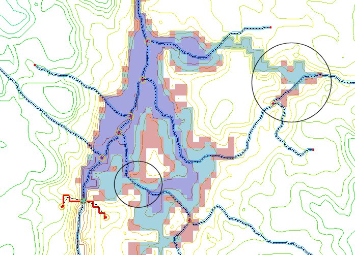
- Don’t set the maximum WSE so high that adjacent areas of ponding (i.e. what should be neighboring lakes) are included. The lakes grow in order of lowest to highest cell elevations and thus GSSHA cannot realistically simulate a disjointed lake bottom. You can put an embankment there separating the two lakes and actually make two lakes
|
| Fig. 22. |
There are two problem areas here relating to the previous point. The first is in the lower left where a stream cuts across a divide. The lake order thus dictates that disjointed portions of the stream may be flooded. This is not allowed to happen in GSSHA. The other problem is similar in nature in that as the lake rises it is able to capture a stream at a disjointed location.
|
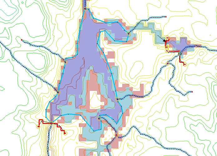
| Fig. 23. |
One way to solve these problems is to create a lake polygon for the lower lake. This eliminates the internal drainage patterns of the lake and simplifies the problem. To solve the disjointed capture of the stream, another lake was created where the ponding after the capture would occur. At the connection point a low spot in the embankment was placed (at the arrow) allowing the two lakes to communicate. An alternative to the one large lake polygon would have been to create a few smaller lakes separated by embankments but with low points allowing the smaller lakes to communicate and act together as a larger lake.
- If there are ponding areas adjacent to lakes (i.e. adjacent ponded cells above the max WSE) you probably ought to have a stream there.
- The cell in which a stream outlet is placed must be below the minimum water surface elevation.
Related Topics
GSSHA Wiki Main Page
Primer Main Page